Category Archives: Roads

Road Safety in Kerala: 5 Tips for a Safer Drive on NH544

Driving on Kerala’s roads, especially on NH 544 (Salem-Kochi Highway), requires caution, attentiveness, and adherence to safety measures. Known for its picturesque landscapes, this busy stretch of road also witnesses heavy vehicular traffic, making road safety a top priority. Whether you are a seasoned driver or someone new to this route, implementing these road safety tips can help you enjoy a safer driving experience.

1. Stick to Speed Limits

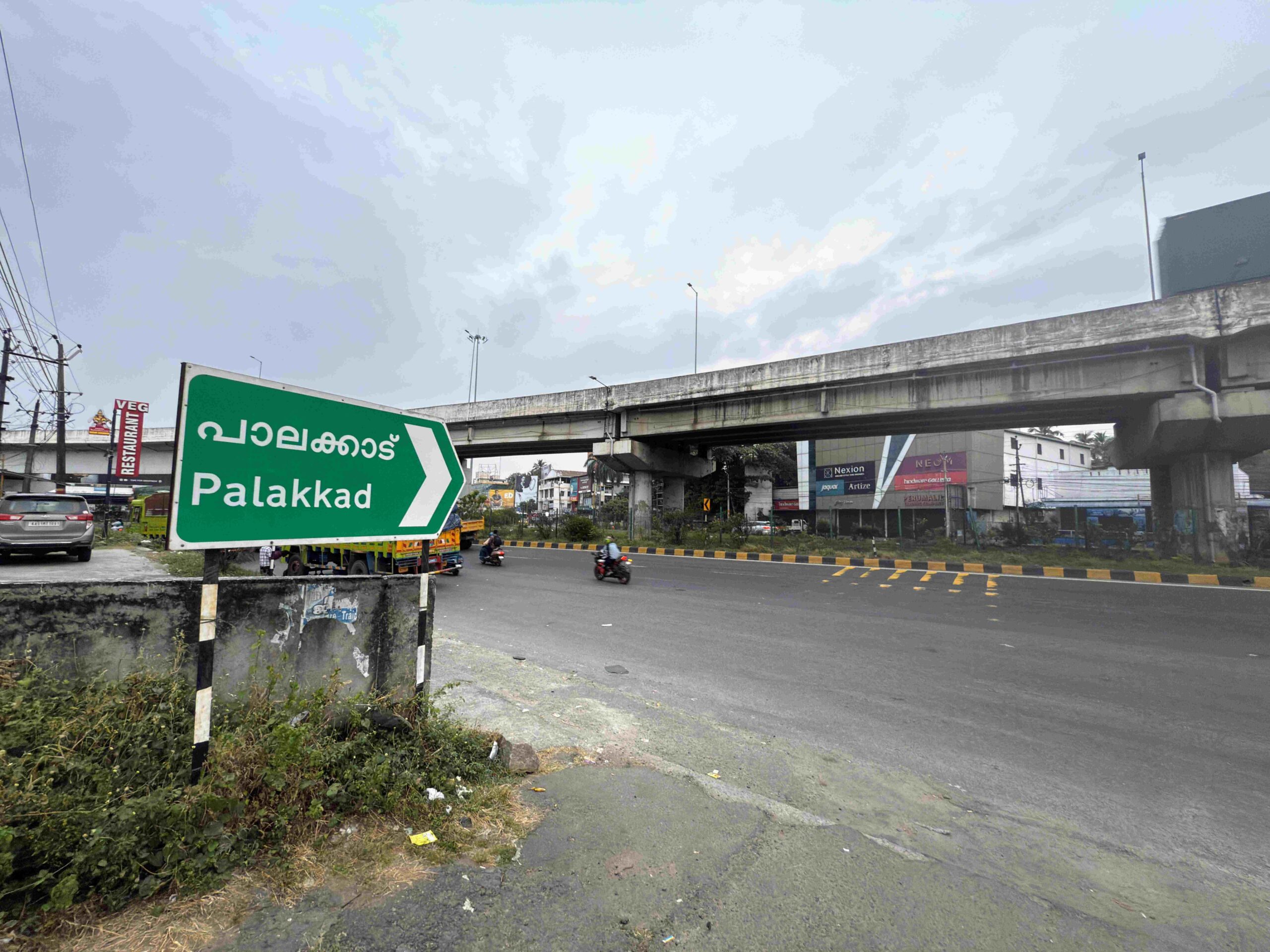
Overspeeding is one of the leading causes of road accidents, particularly on highways. NH 544, with its mix of urban and semi-urban areas, has speed limits that vary depending on the zone. Always adhere to posted speed limits, especially near towns like Palakkad where pedestrians and cyclists are common. Reducing your speed not only ensures your safety but also allows you to respond better to unexpected situations.

Pro Tip:

Keep an eye out for speed cameras and road signs, as authorities in Kerala are actively enforcing speed limits.


2. Be Mindful of Weather Conditions

Kerala’s tropical climate means frequent rains, which can make roads slippery and reduce visibility. NH 544, passing through Palakkad and other districts, is particularly challenging during the monsoon season. Wet roads increase braking distance, and water puddles can lead to hydroplaning.

Safety Tips for Rainy Days:

  • Ensure your windshield wipers and headlights are in top condition.
  • Maintain a greater distance from the vehicle ahead of you.
  • Avoid sudden braking or accelerating on wet surfaces.

3. Avoid Distracted Driving

Distracted driving is a growing concern on NH 544. With a mix of private vehicles, buses, and trucks, any momentary lapse in attention can lead to accidents. Avoid using mobile phones while driving and focus on the road ahead.

Stay Focused:

  • Use hands-free devices if taking calls is necessary.
  • Avoid eating, drinking, or engaging in any activity that takes your hands off the wheel or eyes off the road.

4. Be Cautious Around Heavily Trafficked Areas

Certain sections of NH 544, especially near Palakkad, experience heavy traffic due to markets, toll plazas, and intersections. Be particularly vigilant in these areas, as pedestrians, cyclists, and two-wheelers often share the road.

Navigating High-Traffic Zones:

  • Reduce speed and be prepared to stop suddenly.
  • Always yield to pedestrians at crossings.
  • Use indicators well in advance before making turns.

5. Plan Ahead and Stay Alert

NH 544 can be unpredictable, with construction zones, sudden diversions, and heavy traffic during peak hours. Planning your route in advance and staying updated on traffic conditions can make your journey smoother and safer.

Tips for Better Planning:

  • Use navigation apps to check real-time traffic updates.
  • Avoid peak hours whenever possible, especially near major towns.
  • Ensure your vehicle is in good condition before starting long drives.

Additional Safety Tips for Drivers in Palakkad and Beyond:

  • Always wear your seatbelt and ensure passengers do the same.
  • Avoid driving under the influence of alcohol or medications that cause drowsiness.
  • Keep an emergency kit with essential supplies like a flashlight, first-aid kit, and basic tools.

Why Road Safety Matters on NH 544

NH 544 is a lifeline connecting many important towns and cities in Kerala, including Palakkad. However, its significance comes with responsibilities for drivers and authorities alike. By following these road safety tips, you not only protect yourself but also contribute to making Kerala’s roads safer for everyone.

Let’s work together to reduce accidents and ensure that every journey is a pleasant and safe experience.


Final Thoughts

Road safety is a shared responsibility. By staying vigilant and practicing safe driving habits, you can navigate NH 544 with confidence. Have a safe drive and enjoy the beauty of Kerala responsibly.

Urgent Need to Relocate Vehicle Inspections from Busy SH27 in Palakkad

The Kerala Motor Vehicles Department Chittur (Palakkad District, KL 70) is under scrutiny for conducting regular vehicle inspections on the busy Palakkad-Pollachi SH27 near Mooppan Kulam. This stretch of road, already a crucial and heavily trafficked inter-state highway, becomes even more congested and hazardous when vehicle inspections are conducted on-site. The practice has raised significant concerns among road users and local safety advocates.

The Problem: Safety Risks and Traffic Congestion

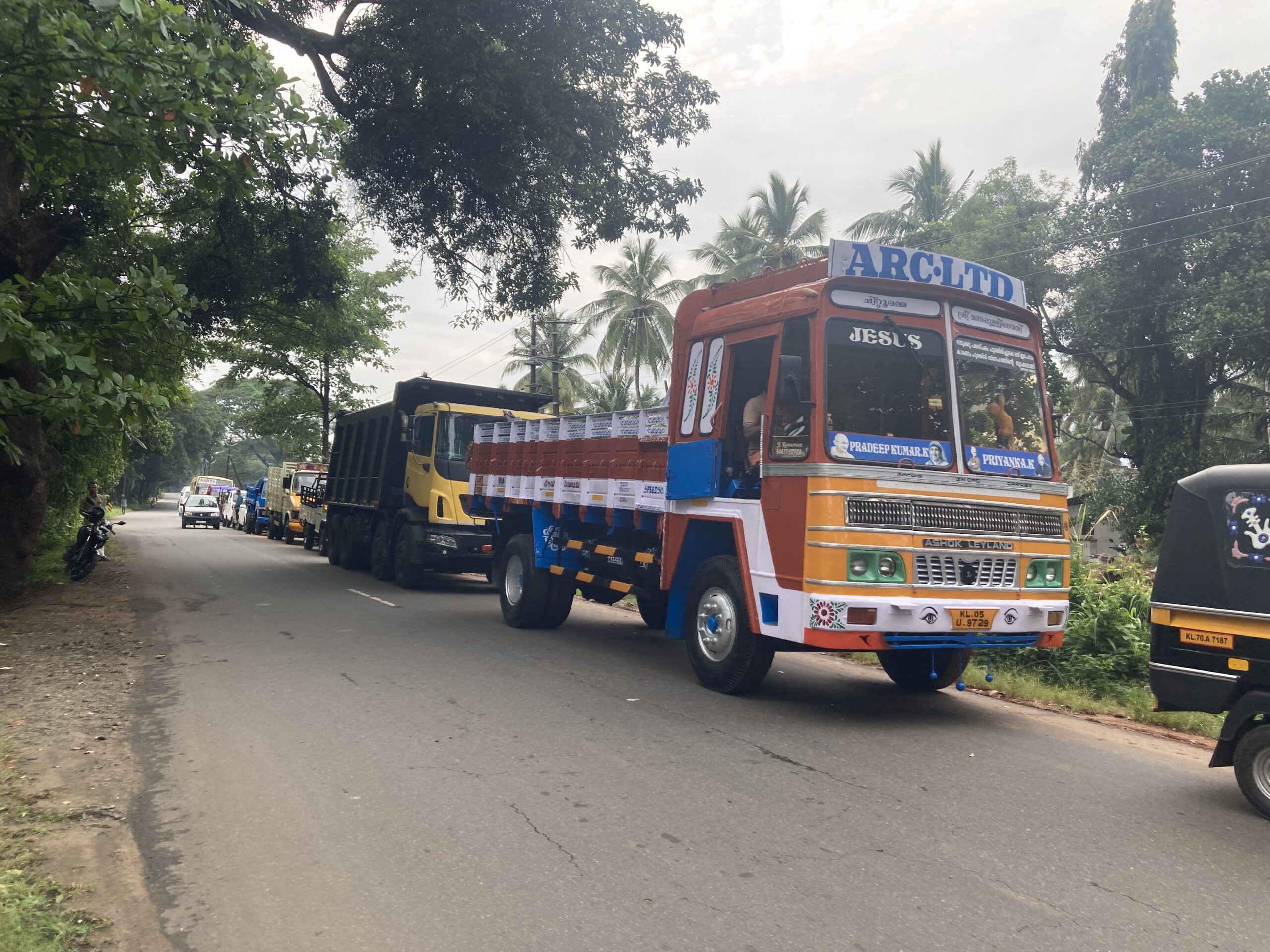
The vehicle inspections conducted by the Motor Vehicles Department often lead to long queues that occupy half of the already narrow state highway. This creates severe traffic congestion and increases the risk of accidents for all road users. The situation becomes especially dangerous during peak traffic hours when the flow of vehicles is at its highest.

Palakkad Roads & Rails, a community group focused on road safety awareness, has been actively monitoring the situation. The group has submitted an official complaint to the concerned authorities, urging immediate action to prevent possible accidents and ensure the safety of motorists.

Irony in the Department’s Actions

One of the most concerning aspects of this issue is the irony in the Motor Vehicles Department’s behavior. On one hand, the department uses its social media channels to promote road safety and educate the public about accident prevention. On the other hand, it engages in actions that contradict its own messages, such as conducting vehicle inspections in locations that pose a risk to road safety.

Palakkad Roads & Rails Takes Action

Palakkad Roads & Rails has raised this issue to the authorities, demanding an immediate change. The group has also shared photographic and video evidence, captured on November 1, 2024, that clearly illustrates the dangerous and congested conditions caused by the inspections.

What Needs to Change?

The community and road safety advocates are urging the Kerala Motor Vehicles Department to take the following actions:

  • Stop Conducting Inspections on the Busy SH27: To ensure the safety of motorists and prevent possible accidents, inspections should be halted on this critical road.
  • Choose a Safer, Open Ground for Inspections: The inspections should be relocated to a suitable open ground, away from roadways, where they can be conducted without endangering lives or disrupting traffic.

Call to Action 

We implore the concerned authorities to prioritise the safety of road users and act swiftly to relocate these inspections. A safer, more appropriate location must be chosen for vehicle inspections to prevent potential tragedies. Until then, the risk of accidents looms over every motorist traveling along this stretch of SH27.


The actions of the Kerala Motor Vehicles Department are, unfortunately, causing avoidable traffic disruptions and creating a serious safety hazard. It is high time that the department practices what it preaches and makes road safety a top priority. Palakkad Roads & Rails will continue to advocate for road safety and work towards ensuring the authorities address this issue promptly.

For more updates on road safety and other local news, stay connected with Palakkad Roads & Rails. Together, we can make our roads safer for everyone.


Palakkad’s Road Woes: A Call for Immediate Action

Palakkad’s Road Woes: A Call for Immediate Action

Palakkad, known as the gateway to Kerala, is a district of historical significance and natural beauty. However, its charm is being overshadowed by the deplorable condition of its roads. It’s time to shine a spotlight on these issues and call for immediate action. This blog will delve into the pressing problems affecting Palakkad’s roads and the urgent need for comprehensive solutions.

A Sea of Potholes: The Current State of Palakkad’s Roads

A staggering 70% of roads in Palakkad town and the entire district are riddled with potholes and prone to waterlogging. These craters and waterlogged sections not only make driving a nightmare but also pose severe risks to the safety of commuters. Motorists and pedestrians alike face daily hazards, including accidents and vehicle damage.

The rains exacerbate the situation, turning potholes into mini ponds, making navigation perilous. The lack of proper road maintenance and timely repairs further deteriorates the conditions. The local authorities need to prioritize road repair and maintenance to ensure safer travel for everyone.

Pedestrians: The Forgotten Lot

In Palakkad, pedestrians face immense challenges. The facilities for pedestrians are close to zero. Footpaths, where they exist, are often in poor condition, encroached upon, or obstructed. In many areas, footpaths are non-existent, forcing people to walk on the roads, exposing them to traffic dangers.

Senior citizens, children, and those with disabilities are particularly vulnerable. The absence of pedestrian crossings, signals, and proper lighting further aggravates the situation. It’s crucial to design urban infrastructure with pedestrians in mind, ensuring safe and accessible pathways for all.

Inadequate Drainage Systems: A Persistent Issue

Most roads in Palakkad are built without proper drainage systems, focusing solely on vehicular traffic. This shortsighted approach leads to frequent flooding during the monsoon season. Without adequate drainage, water accumulates on the roads, causing extensive damage to the pavement and creating hazardous driving conditions.

The lack of drainage infrastructure not only affects the roads but also contributes to waterlogging in residential and commercial areas. The stagnant water becomes a breeding ground for mosquitoes, increasing the risk of vector-borne diseases. A well-planned drainage system is essential for the longevity of the roads and the health and well-being of the community.

The Need for Comprehensive Urban Planning

The road woes of Palakkad highlight a significant gap in urban planning. To address these issues, a comprehensive approach is needed. Here are some key steps that should be taken:

  1. Regular Maintenance and Repair: Establish a robust system for the regular maintenance and repair of roads. Prompt filling of potholes and addressing waterlogging issues should be a priority.
  2. Pedestrian-Friendly Infrastructure: Design and implement pedestrian-friendly infrastructure, including footpaths, pedestrian crossings, and proper lighting. Ensure these facilities are accessible to all, including the elderly and disabled.
  3. Effective Drainage Systems: Invest in building and maintaining effective drainage systems to prevent waterlogging. Proper drainage will protect the roads from damage and improve overall urban hygiene.
  4. Community Involvement: Engage the local community in the planning and maintenance process. Public feedback can provide valuable insights into the most pressing issues and help in prioritizing actions.
  5. Sustainable Practices: Use sustainable construction practices and materials that can withstand the local climate and reduce the frequency of repairs.

A Call for Immediate Action

The current state of Palakkad’s roads is a testament to the urgent need for improved infrastructure and urban planning. The district’s residents deserve safe, well-maintained roads that cater to both vehicular and pedestrian traffic. Addressing these issues requires immediate action from local authorities, community involvement, and a commitment to sustainable practices.

Palakkad’s road woes are not just an inconvenience; they are a serious threat to public safety and health. It’s time to demand better infrastructure and call for the necessary changes to make Palakkad a safer and more accessible place for everyone. The road to improvement starts with recognizing the problems and taking decisive action. Let’s pave the way for a better Palakkad.

By addressing these critical issues, Palakkad can transform its infrastructure, ensuring safer roads and a better quality of life for its residents. The time for action is now. Let’s work together to make Palakkad’s roads a model of safety and efficiency.

Thoughts on the Vizag-Raipur Expressway Development 

As the construction of the Vizag-Raipur expressway progresses, it’s disheartening to witness the extensive destruction of forest lands. Thousands of trees, which are vital for biodiversity, are being cut down to pave the way for this new route. It’s a distressing sight for anyone who values environmental preservation.

Why not consider alternative solutions? In many western countries, elevated expressways are a common solution that minimises environmental impact. Such designs leave the forests intact, maintaining ecological balance while still providing infrastructural developments.

We fully support development and progress, but it’s painful to see it come at such a high environmental cost. It was crucial to explore every possibility before deciding to cut through dense forests. Could the planners not have found a different alignment that spared our precious green cover?

The loss of trees is not just a loss of green space but a setback for wildlife and local climates. While we hope there are serious efforts for afforestation, it’s essential that these are not just token gestures. We need real, impactful actions to replace what we’ve lost, ideally with the same dedication used to plan major infrastructure projects.

Let’s advocate for smarter, more sustainable infrastructure planning that doesn’t sacrifice our natural resources.  

#SaveOurForests #SustainableDevelopment #VizagRaipurExpressway

Video Courtesy of this twitter post 


Bangalore to Hampi Road Trip 2023: A Detailed Tour Plan

Embark on a mesmerizing journey from the bustling city of Bangalore to the historic ruins of Hampi. This road trip promises a blend of urban charm, natural beauty, and ancient grandeur.

Day 1: Departure from Bangalore

Morning:
– 6:00 AM: Depart from Bangalore. Ensure your vehicle is in good condition, and you have all essentials like water, snacks, and a first-aid kit.
– 8:30 AM: Breakfast stop at Chitradurga. Try local delicacies like Dosa and Vada at a highway restaurant.

Afternoon:
– 12:30 PM: Reach Hospet. Have lunch and take a short break.
– 2:00 PM: Proceed to Hampi.

Evening:
– 4:00 PM: Arrive in Hampi. Check into your pre-booked hotel.
– 5:30 PM: Visit the Hampi Bazaar for some local shopping and exploration.
– 7:30 PM: Return to the hotel. Dinner and rest.

Day 2: Exploring Hampi

Morning:
– 7:00 AM: Breakfast at the hotel.
– 8:00 AM: Start your day with a visit to the Virupaksha Temple, an iconic structure of Hampi.
– 10:00 AM: Explore the Hemakuta Hill Temples.

Afternoon:
– 12:30 PM: Lunch at a local eatery. Try the regional cuisine.
– 2:00 PM: Visit the Royal Enclosure to witness the Lotus Mahal, Elephant Stables, and the Queen’s Bath.
– 4:00 PM: Explore the Vittala Temple and its famous stone chariot.

Evening:
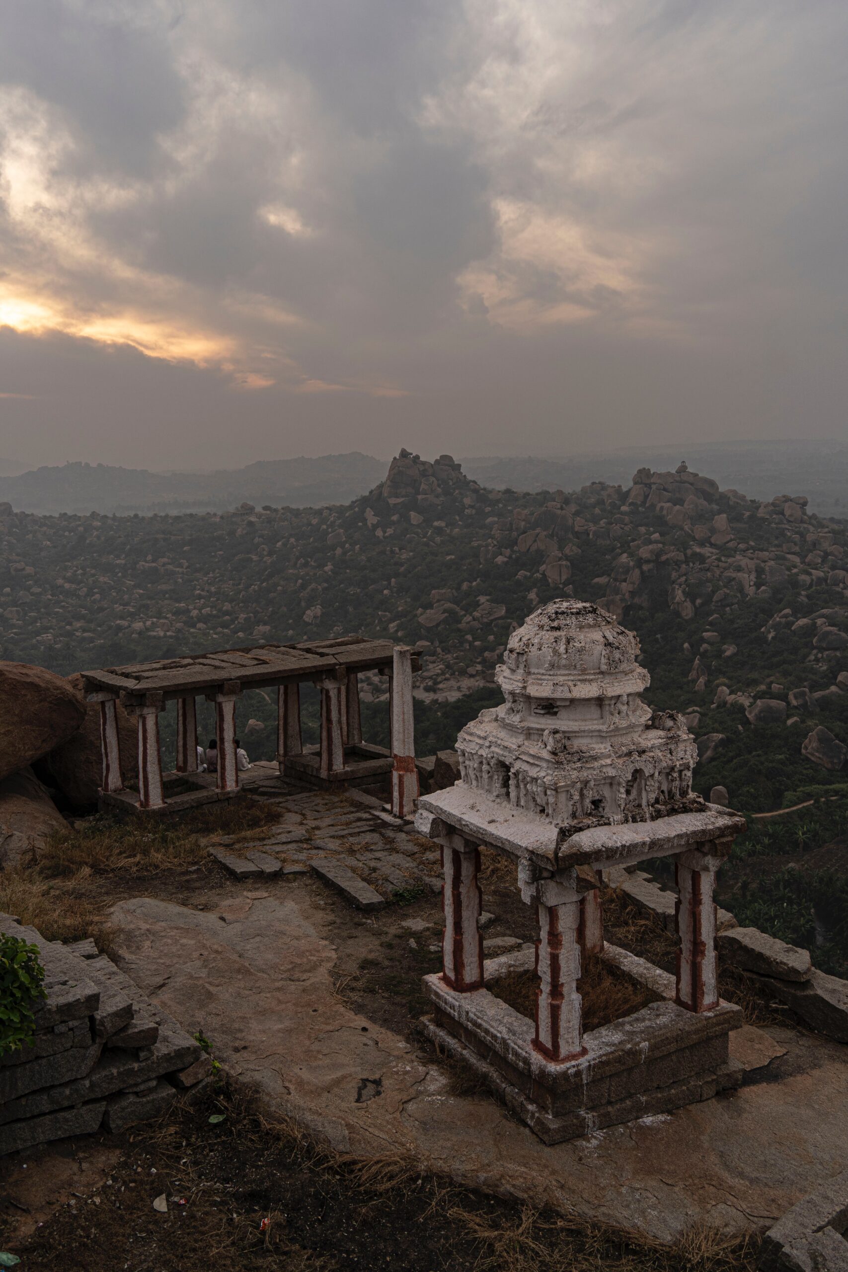
– 6:00 PM: Enjoy a serene sunset at the Matanga Hill.
– 8:00 PM: Dinner at a local restaurant. Try the Thali for a variety of flavors.

Day 3: Delving Deeper into Hampi’s History

Morning:
– 7:00 AM: Breakfast at the hotel.
– 8:00 AM: Head to the Riverside Ruins, which includes the Yeduru Basavanna and the Kodandarama Temple.
– 10:00 AM: Explore the Underground Shiva Temple.

Afternoon:
– 12:00 PM: Lunch at Mango Tree, a popular restaurant in Hampi.
– 1:30 PM: Visit the Hazara Rama Temple and the Archaeological Museum.
– 3:30 PM: Explore the Monkey Temple (Hanuman Temple) and enjoy panoramic views of Hampi.

Evening:
– 5:30 PM: Leisure time. You can opt for a coracle ride in the Tungabhadra River.
– 7:30 PM: Return to the hotel. Dinner and rest.

Day 4: Return to Bangalore

Morning:
– 7:00 AM: Early breakfast and check-out from the hotel.
– 8:00 AM: Depart from Hampi.

Afternoon:
– 12:30 PM: Lunch stop at Hospet.
– 2:00 PM: Continue the journey towards Bangalore.

Evening:
– 6:00 PM: Reach Bangalore. The road trip concludes with cherished memories of Hampi’s historic charm.

Tips for the Trip:

  1. Ensure your vehicle is serviced before the trip.
  2. Carry cash as not all places in Hampi might have card payment facilities.
  3. Wear comfortable shoes as there’s a lot of walking involved in Hampi.
  4. Stay hydrated and wear sunscreen.
  5. Respect the local customs and traditions.


Hampi: The Historical Jewel of India

Location:
Hampi is located in the southern state of Karnataka, India. It lies within the ruins of the ancient city of Vijayanagara, near the banks of the Tungabhadra River.

Historical Significance:

1. Capital of the Vijayanagara Empire:

Hampi was the capital city of the powerful Vijayanagara Empire, which ruled South India from the 14th to the 16th century. The empire was one of the most prosperous and influential kingdoms in India’s history.

Architectural Marvel:

The ruins of Hampi are renowned for their intricate architecture, which blends both Dravidian and Indo-Islamic styles. The city’s structures, built using massive boulders, include temples, palaces, market streets, aquatic structures, and fortifications.

Cultural Hub:

In its prime, Hampi was not only a political and military capital but also a vibrant cultural hub. It attracted traders, scholars, and artists from various parts of the world, making it a melting pot of diverse cultures and traditions.

Religious Significance:

Hampi is home to several historically important temples. The Virupaksha Temple, dedicated to Lord Shiva, is among the city’s most iconic structures and continues to be a significant pilgrimage site.

UNESCO World Heritage Site:

Recognizing its historical, architectural, and cultural significance, the ruins of Hampi were designated a UNESCO World Heritage Site in 1986.

Decline and Ruin:

Despite its grandeur, Hampi faced a tragic downfall. In 1565, the city was besieged and subsequently plundered by a coalition of Muslim sultanates in the Battle of Talikota. The once-magnificent city was reduced to ruins, which today stand as a testament to its former glory.

Literary References:

The history and grandeur of Hampi have been documented in various ancient texts and inscriptions. The empire and its capital have been mentioned in accounts by foreign travelers, including the Portuguese traveler Domingo Paes and the Persian ambassador Abdur Razzak.

Hampi stands as a poignant reminder of India’s rich historical and cultural heritage. The ruins, with their silent stories of grandeur, tragedy, and resilience, continue to captivate historians, archaeologists, and travelers from around the world.

Charting the Course for Safer Roads: Enhancing Driving Behaviour in India

India, with its rich cultural diversity and a vast populace, holds an intriguing facet that needs urgent reformation – the driving behaviour of its citizens. The chaotic traffic scenes witnessed on Indian roads is a testament to the fact that improved driving etiquette can significantly contribute to safer and more orderly roads. This article proposes a multi-faceted approach for driving this transformation, considering it as a social reform of vital importance.

Understanding the Status Quo:

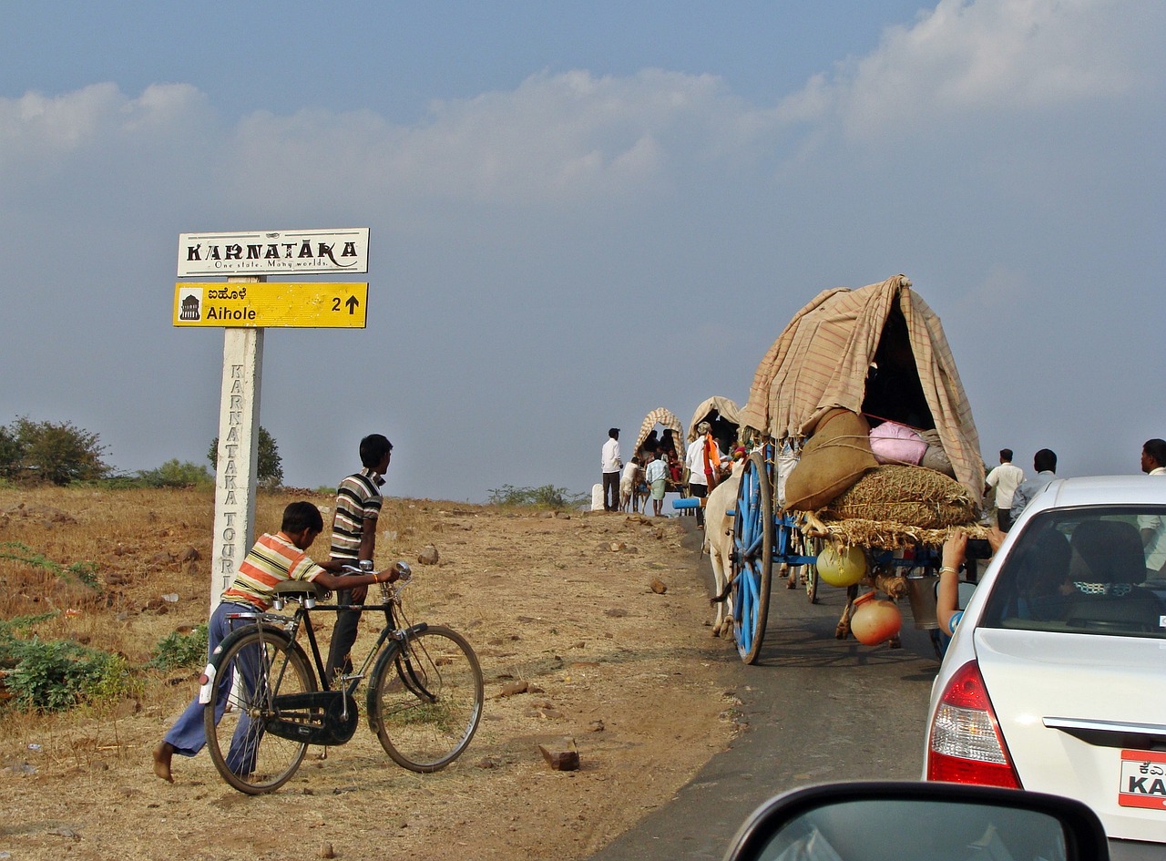
Firstly, we must acknowledge the current state of affairs. Indian roads are teeming with a mix of vehicles ranging from bikes to cars, trucks, and even animal-drawn carts. Moreover, there is a considerable variation in driver’s ages, educational backgrounds, and understanding of traffic rules. This diversity, while reflecting our vibrant culture, often leads to violations of traffic norms, creating safety hazards.

Creating Awareness:

Awareness and education form the backbone of any reform. The citizens need to be made cognizant of the traffic rules and the implications of their violations. Incorporating traffic education in school curriculums, conducting community awareness drives, and leveraging media platforms for propagating the message are steps towards achieving this objective.

Enhancing Licensing Process:

We must overhaul the driving licensing system, making it more stringent and comprehensive. Instead of merely testing a person’s ability to operate a vehicle, the process should assess their understanding of traffic rules, road signage, and emergency protocols. Incorporating theoretical and practical exams, and making periodic refresher courses mandatory, will ensure only informed and responsible individuals handle the wheel.

Strict Enforcement of Traffic Rules:

Merely educating the citizens won’t suffice; we must establish a strict enforcement mechanism. Increasing penalties for violations, introducing demerit points system, and leveraging technology like surveillance cameras and speed detection devices can deter potential violators.

Improving Infrastructure:

Infrastructure development plays a crucial role in ensuring road safety. Well-structured roads, clear signage, and efficient traffic management systems can significantly influence driving behaviour. Therefore, the authorities must ensure adequate investment and planning in this regard.

Promoting Public Transport:

Public transport alleviates road congestion, which indirectly improves driving behaviour. Enhancing the reach and quality of public transport can encourage citizens to prefer it over private vehicles, thereby reducing the chaos on the roads.

Improving driving behaviour is not an overnight process; it requires a consistent and collective effort from the government, authorities, and most importantly, the citizens. It is high time we considered safe and disciplined driving not just as an individual responsibility but as a collective societal commitment. The journey might be long, but with perseverance and dedication, we can transform Indian roads into safer avenues, bringing about a truly life-saving reform.

Image by Shiva Reddy from Pixabay

Navigating the Globe: An In-Depth Exploration of Road Networks in China, Germany, USA, India, Russia, Australia, and Brazil

Road networks play an integral role in the social and economic fabric of any country, providing critical links for people, goods, and services. This blog post invites you to take an expansive journey across continents to explore the intricate road networks of seven diverse nations: China, Germany, the United States, India, Russia, Australia, and Brazil.

China: Embracing the Great Road Expansion

China, a country known for its rich history and rapid economic growth, boasts the most extensive road network globally. According to the latest data, China’s road network stretches over an incredible 5.2 million kilometers, a figure that continues to rise as the country expands its infrastructure.

The backbone of this intricate web is the National Trunk Highway System (NTHS), China’s equivalent of the expressway. The NTHS, boasting around 160,000 kilometers of expressways, is strategically designed in a grid pattern, connecting all major cities and facilitating efficient travel and trade routes that fuel China’s bustling economy. The comprehensive network of national, provincial, county, and township roads ensures connectivity to even the most remote corners of this vast nation.

Germany: Autobahn and Precision Engineering

Germany’s road network, spanning over 231,000 kilometers, is known worldwide for the famous Autobahn. The Autobahn, a federally controlled-access highway system with areas devoid of a mandatory speed limit, is an engineering marvel embodying German precision and efficiency.

But the network extends beyond the iconic Autobahn. It encompasses a comprehensive system of Bundesstraßen (federal roads), Landesstraßen (state roads), and Kreisstraßen (district roads). These intricately interlinked routes ensure seamless connectivity across the country, contributing significantly to Germany’s strong economy and high living standards.

United States: Diversity and History Paved Into Roads

With its roads sprawling over 6.8 million kilometers, the United States possesses one of the most diverse and extensive road networks worldwide. The interstate highway system, modeled after Germany’s Autobahn, was a remarkable post-war development and continues to play a critical role in national connectivity and economic growth.

Historic routes such as Route 66, while officially decommissioned, remain cultural icons. Today, the U.S. road network seamlessly weaves together bustling cities, sprawling suburbs, and vast rural areas, reflecting the nation’s diversity and expansive landscapes.

India: A Vibrant Mosaic of Roadways

In India, the road network faces the unique challenge of accommodating an exceptionally diverse terrain, including towering Himalayan peaks, vast plains, dense forests, and coastal regions. Despite these hurdles, India has built one of the largest road networks globally, stretching over 5.9 million kilometers.

The network includes National Highways, State Highways, and other roads, each playing a distinct role in linking India’s teeming cities and villages. Noteworthy is the Golden Quadrilateral project, an ambitious highway network connecting India’s four major metropolitan cities—Delhi, Kolkata, Chennai, and Mumbai.

Russia: A Network Stretched Across Extremes

Russia’s road network, spanning over 1.4 million kilometers, faces the dual challenge of vast distances and harsh climatic conditions. Despite these challenges, Russia’s roadways—most notably, the Trans-Siberian Highway, one of the longest national highways globally—symbolize the nation’s resilience and adaptability.

However, providing robust connectivity to remote regions remains a formidable challenge for Russia. Many areas, particularly in the expansive Siberian and Far Eastern regions, are still difficult to access, underscoring the ongoing developmental challenges.

Australia: Bridging the Great Outback

Australia’s road network, though not the most extensive at over 877,000 kilometers, plays a crucial role in linking its sparsely populated areas. Highways like the Stuart Highway, running from the northern to the southern coast through the heart of the continent, serve as vital lifelines in this vast and diverse landscape.

The challenge lies in maintaining these lengthy roads, ensuring their usability across Australia’s varied climates. However, Australia’s ongoing infrastructure developments and maintenance projects demonstrate the nation’s commitment to surmounting these challenges.

Brazil: Paving the Way for the Future

Brazil, with its rich diversity of landscapes and expansive size, faces the herculean task of creating an extensive and efficient road network. As of now, the total road length in Brazil is about 1.7 million kilometers.

Major highways like the BR-116, which runs from the north to the south of the country, play a crucial role in internal connectivity. Nevertheless, the country grapples with significant challenges such as uneven road quality, poor maintenance, and limited reach to certain regions. Addressing these issues remains an ongoing task for Brazil’s infrastructure development plans.

Road networks are as diverse as the countries they lace through, each embodying a unique tale of human ingenuity, adaptability, and perseverance. Whether it’s the vast expressways of China, the precision-engineered autobahns of Germany, the diverse roads of the U.S., the vibrant mosaic of India’s highways, Russia’s resilient passages, the lifelines across Australia’s outback, or Brazil’s developmental strides, each road network stands as a testament to human ambition and progress. With continued innovation and development, these networks will undoubtedly continue to evolve, offering more connectivity and opportunities for growth in the years to come.

Image by Karl Oss Von Iya from Pixabay

Road Markings: Enhancing Safety and Navigation on Highways

Road markings are essential elements of transportation infrastructure, providing visual cues that guide and inform drivers on highways. These markings, combined with road signals, play a crucial role in ensuring safe and efficient traffic flow. In this article, we will explore the significance of road markings, focusing on their importance in India and the various types and specifications as per IRC 35 and MoRTH guidelines. We will also provide examples of commonly used road markings and their names.

1. Importance of Road Markings

Highway Road Markings: Highway road markings are specifically designed to enhance safety and facilitate smooth traffic movement on highways. They provide valuable information to drivers, such as lane divisions, turn lanes, pedestrian crossings, and other regulatory and warning signs. These markings play a vital role in preventing accidents, guiding drivers in adverse weather conditions, and improving overall road discipline.

Road Signals: Road signals work in conjunction with road markings to regulate traffic at intersections and facilitate safe movements. They convey instructions to drivers, indicating when to stop, yield, or proceed, ensuring orderly traffic flow and minimizing conflicts. Road signals are typically positioned at strategic locations and are coordinated with road markings for effective traffic management.

2. Road Markings in India

Road Markings as per IRC 35: The Indian Roads Congress (IRC) has defined guidelines for road markings under IRC 35. These guidelines specify the dimensions, colors, and placement of various road markings. As per IRC 35, road markings in India include center lines, edge lines, lane markings, pedestrian crossings, stop lines, and zebra crossings. These markings follow standardized patterns and help regulate traffic and ensure driver safety.

Road Marking Specifications as per MoRTH: The Ministry of Road Transport and Highways (MoRTH) in India also provides specifications for road markings. These specifications outline the materials, dimensions, and application methods for different types of road markings. MoRTH guidelines ensure uniformity and adherence to quality standards in road marking implementation across the country.

3. Examples and Types of Road Markings

a) Center Lines: Center lines are markings that divide the road into separate traffic streams, indicating the boundaries between opposing lanes of traffic. They assist drivers in maintaining their positions and prevent head-on collisions. Center lines can be solid or broken, with variations depending on the type of road and traffic conditions.

b) Edge Lines: Edge lines mark the outer edges of the roadway, separating the traffic lanes from the shoulder or roadside. They provide visual guidance and help drivers maintain their positions, particularly during low light conditions or poor visibility. Edge lines can be solid or broken, with different colors denoting specific conditions or restrictions.

c) Lane Markings: Lane markings divide the road into individual lanes and assist drivers in staying within their designated lanes. These markings help regulate traffic flow, enable lane changes, and enhance safety. Lane markings include solid lines, dashed lines, and arrows, providing information about overtaking zones, merging lanes, and designated turning lanes.

d) Pedestrian Crossings: Pedestrian crossings, such as zebra crossings, play a crucial role in ensuring pedestrian safety. These marked areas allow pedestrians to cross the road safely and indicate to drivers that they should yield to pedestrians. Zebra crossings consist of white parallel stripes across the road, accompanied by appropriate signage.

e) Stop Lines: Stop lines are horizontal markings placed before intersections or junctions, indicating the point at which drivers must stop their vehicles. These lines ensure that vehicles halt before entering intersections, allowing for safe and orderly traffic flow. Stop lines are typically solid white lines and are accompanied by stop signs or traffic signals.

f) Other Markings: Road markings also include various other symbols and signs to convey specific information to drivers. These may include arrows indicating mandatory or recommended directions, speed limit markings, bus lane markings, bicycle lane markings, and crosswalk markings near schools or hospitals.


Road markings, in conjunction with road signals, play a critical role in ensuring safe and efficient traffic flow on highways. In India, road markings adhere to guidelines specified by IRC 35 and MoRTH, ensuring standardized and uniform implementation across the country. Center lines, edge lines, lane markings, pedestrian crossings, stop lines, and zebra crossings are some examples of road markings that help regulate traffic, enhance safety, and provide clear navigation instructions to drivers. By understanding and following road markings, drivers can contribute to a safer and more organized road environment, reducing the risk of accidents and ensuring a smoother journey for all road users.

Image by Hands off my tags! Michael Gaida from Pixabay

Enhancing Connectivity and Development: Exploring the Significance of Panchayat Roads in India

In the vast and diverse landscape of India, the development of infrastructure plays a pivotal role in fostering economic growth and improving the quality of life for its citizens. One critical aspect of this infrastructure is the extensive network of Panchayat roads that crisscross the nation. These roads, which connect rural areas to urban centers, hold immense importance in facilitating transportation, trade, and social integration. In this comprehensive article, we delve into the significance of Panchayat roads in India, their impact on rural communities, and their role in propelling overall development.

Understanding Panchayat Roads

Panchayat roads, also known as village roads, are an essential component of India’s transportation infrastructure. They are primarily located in rural areas and are maintained by local governing bodies known as Panchayats. These roads serve as vital links between villages, towns, markets, and other crucial amenities, fostering improved connectivity and accessibility for rural communities.

Facilitating Connectivity

One of the primary objectives of developing Panchayat roads is to enhance connectivity. These roads act as lifelines for rural residents, connecting them to various essential services such as healthcare, education, and employment opportunities. By bridging the gap between rural and urban areas, Panchayat roads facilitate the movement of people and goods, enabling farmers to transport their produce to markets efficiently and supporting trade and commerce in remote regions.

Driving Economic Growth

Panchayat roads play a significant role in stimulating economic growth in rural areas. Improved accessibility provided by these roads opens up avenues for investment, leading to the establishment of businesses and industries. With better transportation infrastructure, entrepreneurs and investors are encouraged to set up ventures in rural areas, creating employment opportunities for the local population. This not only reduces migration from rural to urban areas but also contributes to balanced regional development.

Empowering Rural Communities

The development of Panchayat roads empowers rural communities by providing them with opportunities for social and economic progress. These roads enable access to essential services, including healthcare centers, schools, and markets, thereby improving the overall quality of life. Additionally, enhanced connectivity encourages the exchange of ideas, knowledge, and cultural experiences between rural and urban areas, fostering social integration and harmony.

Improving Agricultural Practices

Agriculture forms the backbone of India’s economy, and Panchayat roads play a crucial role in transforming agricultural practices in rural areas. Farmers can now transport their produce swiftly and efficiently, reducing wastage and ensuring better returns on their investments. Furthermore, improved connectivity enables farmers to access modern farming techniques, machinery, and resources, enhancing agricultural productivity and contributing to food security at a national level.

Addressing Social Disparities

One of the key benefits of developing Panchayat roads is the reduction of social disparities between rural and urban areas. By enhancing connectivity and accessibility, these roads bridge the divide that exists between remote villages and urban centers. Access to education, healthcare, and government services becomes more equitable, ensuring that rural communities have access to the same opportunities as their urban counterparts. This balanced development fosters inclusivity, reduces poverty, and contributes to a more harmonious society.

Panchayat roads in India have emerged as crucial components of the nation’s infrastructure, contributing significantly to rural development, economic growth, and social integration. By enhancing connectivity and accessibility, these roads empower rural communities, create employment opportunities, and improve agricultural practices. Furthermore, they play a pivotal role in bridging the gap between rural and urban areas, reducing social disparities and fostering balanced regional development.

 
Image by Bishnu Sarangi from Pixabay

National Highways Authority of India (NHAI): Spearheading the Revolution in India’s Road Infrastructure

India’s economic progress is intimately linked to its infrastructure growth, with the National Highways Authority of India (NHAI) playing a pivotal role in this narrative. Founded in 1988, the NHAI has overseen the transformation of India’s road infrastructure, making journeys smoother, safer, and more efficient for millions of commuters and transporters across the country. This comprehensive article delves into the heart of NHAI’s operations, contributions, and future endeavors in infrastructure development.

What is the National Highways Authority of India (NHAI)?

The National Highways Authority of India, or NHAI, is an autonomous agency under the Ministry of Road Transport and Highways, Government of India. Established via the National Highways Authority of India Act, 1988, it’s responsible for managing a network of over 50,000 kilometers of national highways. Its principal role involves the development, maintenance, and management of national highways, and the implementation of India’s most ambitious highway development project, the National Highways Development Project (NHDP).

Roles and Responsibilities of NHAI

As India’s apex body for highway management, the NHAI’s responsibilities encompass an extensive range of functions. These duties fall broadly into three categories: construction, maintenance, and regulation.

Construction

NHAI is responsible for the design, construction, and upgrading of national highways throughout India. This task includes planning new highways, executing expansion projects for existing highways, building expressways, and implementing bypasses, bridges, and flyovers to reduce congestion in densely populated areas.

Maintenance

NHAI is entrusted with the maintenance of the national highways. This duty includes regular inspection of roads to identify and repair issues, maintenance of highway furniture, ensuring proper road markings and signage, and attending to any emergent repairs or hazards.

Regulation

NHAI plays a regulatory role in the operations of national highways. It regulates toll rates, ensures adherence to quality standards in highway construction and maintenance, and enforces highway safety norms.

NHAI’s Contributions to India’s Road Infrastructure

Over the years, NHAI has played an instrumental role in the evolution of India’s road infrastructure. From the development of multi-lane highways to the introduction of FASTag, the organization’s work has revolutionized road travel in India.

National Highways Development Project (NHDP)

The most significant contribution of NHAI has been the implementation of the National Highways Development Project (NHDP), the largest highway project ever undertaken in India. The NHDP aims to upgrade, rehabilitate, and widen major highways in India to improve their quality and capacity.

Introduction of Electronic Toll Collection (ETC) via FASTag

In a bid to digitize toll collection and reduce waiting times at toll plazas, NHAI introduced FASTag, an electronic toll collection system that uses Radio Frequency Identification (RFID) technology. This initiative has significantly reduced congestion at toll booths and improved the efficiency of highway travel.

Improved Safety Measures

NHAI has been instrumental in promoting and implementing road safety measures across the national highways. This includes the installation of road signs, crash barriers, and lighting, as well as public awareness campaigns about road safety.

The Future of NHAI: Sustainable and Smart Highways

As we look to the future, the NHAI’s focus is on sustainable and smart highway development. This includes the use of environment-friendly construction materials, energy-efficient highway lighting, and integration of advanced technologies such as Intelligent Transportation Systems (ITS) for real-time traffic management.

The Bharatmala Pariyojana, an umbrella program for the highways sector, envisages the development of about 65,000 km of national highways. The program aims to optimize


Image by Bishnu Sarangi from Pixabay